Africa
UN Backs New World Map That Shows Africa’s True Size More Accurately
The United Nations General Assembly has backed a resolution encouraging the use of a new world map that more accurately represents the size of Africa and other continents. The move challenges the centuries-old Mercator projection, which makes Africa appear far smaller than it actually is.
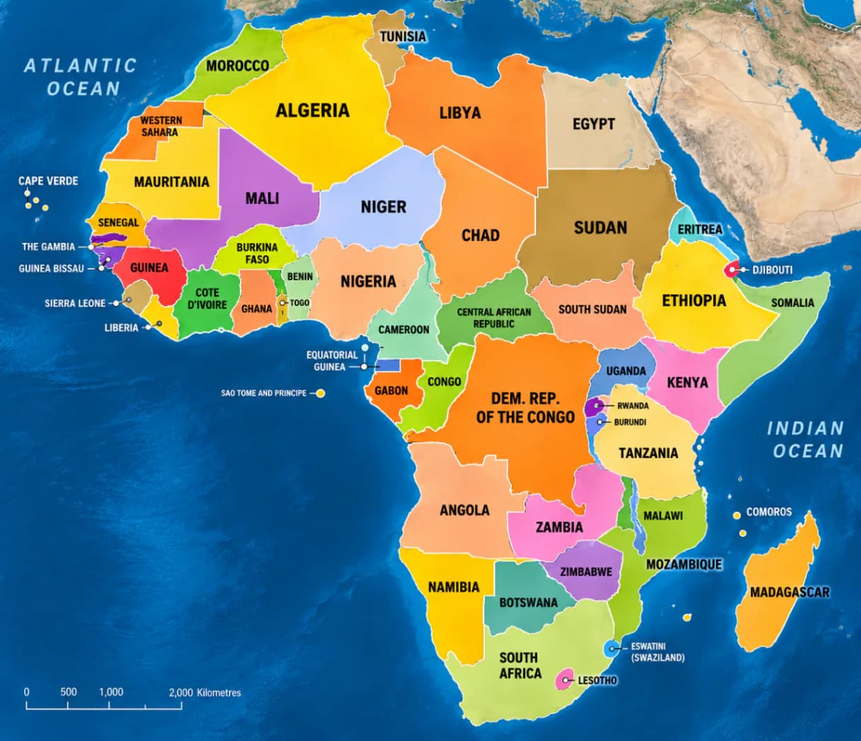
The United Nations has taken a major step toward changing how the world sees Africa on maps.
The UN General Assembly on Friday adopted a resolution supporting the use of the Equal Earth projection, a world map designed to represent the relative size of continents more accurately.
The resolution was passed by 164 countries, while the United States voted against it and six countries abstained.
The initiative was led by Togo and supported by members of the African Union as part of a broader campaign to correct what African countries and advocacy groups describe as a long-standing distortion of the continent’s size.
For generations, millions of people have grown up seeing world maps based on the Mercator projection, a map developed by Flemish cartographer Gerardus Mercator in 1569.
Although the Mercator projection was originally created to help sailors navigate the oceans, it dramatically distorts the size of landmasses as they move farther away from the equator.
That distortion makes countries and regions in the northern and southern extremes appear much larger than they really are.
One of the most striking examples is Greenland.
On a traditional Mercator world map, Greenland can appear almost comparable in size to Africa.
In reality, Africa is approximately 14 times larger than Greenland.
The Equal Earth projection provides a very different picture.
Instead of stretching areas near the poles, it is designed to preserve the relative area of continents, giving viewers a much more accurate understanding of the planet’s geography.
The change is particularly significant for Africa, which is the world's second-largest continent by land area.
The campaign behind the UN resolution argues that maps are not simply educational tools. They can also influence how people understand the importance, scale and position of different parts of the world.
Togo’s Foreign Minister Robert Dussey described the campaign with the phrase, “A fair world begins with a fair map.”
Supporters say the objective is not to make Africa look bigger than it is, but to ensure that people see the continent according to its actual geographical size.
The African Union has backed the campaign, with Togo taking the lead in pushing the issue at the United Nations.
The campaign also calls for more accurate maps to be used in schools, textbooks, newsrooms, businesses and digital platforms.
However, the UN decision does not mean that the Mercator projection has been banned.
The resolution is not legally binding, and the Mercator projection remains useful for certain forms of navigation, including maritime and aerial navigation.
Instead, the UN resolution encourages governments, educational institutions and other organisations to consider more accurate alternatives such as Equal Earth.
Togo has said it intends to begin changing its own school geography materials and encourage other countries to follow.
The debate also highlights an important fact about maps: there is no single flat map that can represent the entire curved surface of Earth without some form of distortion.
Different projections are designed for different purposes.
The Mercator projection is particularly useful for navigation because it preserves directions, but that comes at the cost of distorting the size of landmasses.
Equal Earth takes a different approach by focusing on preserving relative areas.
For Africa, the change could have a powerful educational impact.
A continent that often appears visually reduced on conventional world maps will be shown in a way that more closely reflects its actual physical scale.
The UN vote therefore goes beyond changing the appearance of a map.
It has opened a wider conversation about how geography, education and historical conventions shape the way people understand the world.
Africa has not suddenly become larger.
The continent has always been this large.
What is changing is the way the world is being encouraged to see it.
Key Facts
UN Resolution: Adopted on September 4, 2026
Vote: 164 countries in favour, 1 against and 6 abstentions
Country leading the initiative: Togo
Supported by: African Union members and other countries
Proposed projection: Equal Earth
Traditional projection: Mercator
Mercator projection created: 1569
Africa compared with Greenland: Africa is approximately 14 times larger
Important clarification: The UN resolution is non-binding and does not ban the Mercator projection
Sources
Reuters
Associated Press
The Guardian
Al Jazeera
The African Union
PUBLISHER NOTE
About Talk Ya True
Talk Ya True publishes independent reporting and analysis with clear attribution, source transparency and corrections when needed.
Related Articles

Stay Informed
Get the latest stories from Nigeria.
Free news updates. Unsubscribe anytime.
By subscribing, you agree to receive free news updates from Talk Ya True. You can unsubscribe at any time.